Read carefully.
Follow the sources.
Change the conclusion when the evidence changes.
HISTORY / SIGNAL / NOISE / JOE FELZ SATELLITE 07
A “lost city” is not established by one object, a promising symbol, a tunnel-shaped anomaly or even a LiDAR map. It emerges when mapped architecture, secure context, material culture, dates and independent fieldwork converge on one place.
There is a particular moment in every lost-city story when a possibility becomes a location.
A symbol resembles a map. A local story mentions a tunnel. A carved object appears to show buildings. Somebody points to a rise under the trees. LiDAR is invoked. Then the headline arrives several years before the excavation team.
So I looked at what real lost-city evidence looks like before the headline.
First: “lost” is usually the wrong word
A place can be absent from modern academic maps without being unknown to everyone. Local and Indigenous communities may know its ruins, name, routes or stories. Colonial records may mention it. Looters may have visited it. Archaeologists may know the region but not its full scale. Dense vegetation may conceal its layout without erasing human knowledge.
“Lost city discovered” is therefore often shorthand for something narrower: a previously undocumented settlement, a known site newly mapped at city scale, a monumental centre recognised in remote-sensing data, or a place brought into formal archaeological study.
The language matters because the heroic outsider story can erase the people who never lost it.
How Joe Felz arrived at “A Lost City?”
This strand is one branch of the larger reconstruction of Joe Felz’s final research period. The later internet compresses it into a single revelation. Joe’s own recoverable sequence was more exploratory.
- His interest in energy and frequency led him, he said, to a dusty garage in Central America containing unusual objects.
- He focused on a clock-like object, markings, physical demonstrations and an alleged 45,000-year age.
- He sought comparable objects and collaborators, including material associated with Tula in Mexico.
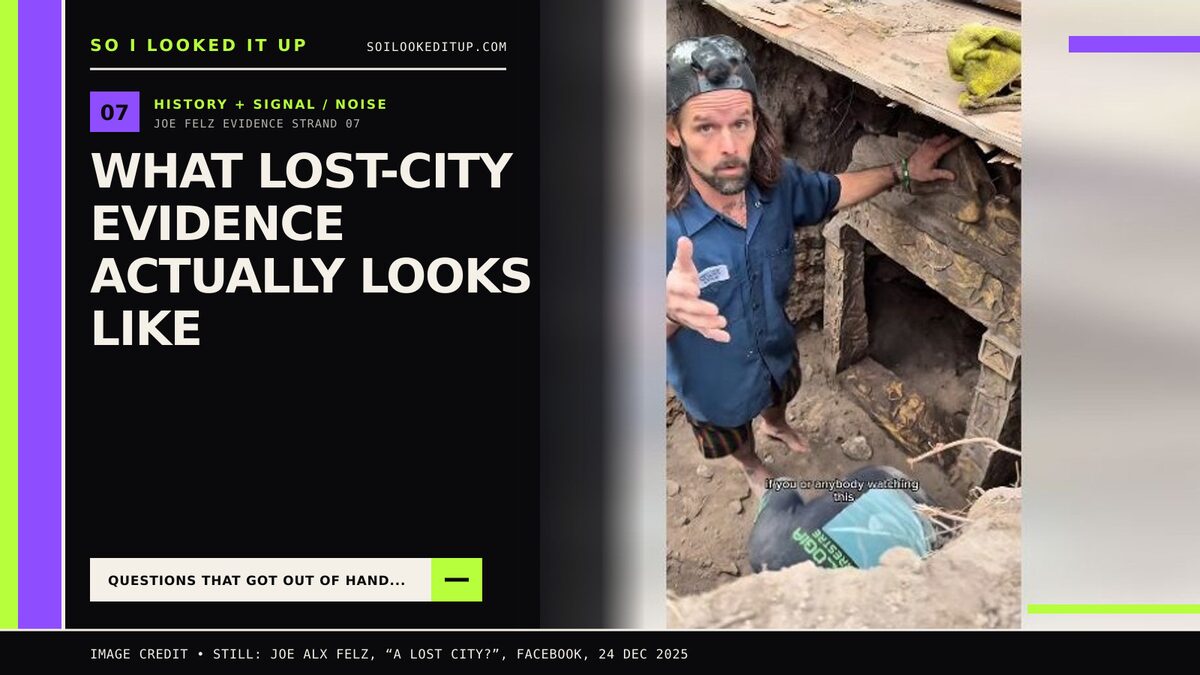
- He posted footage of excavation and argued that digging an object from the ground made a modern-replica explanation less persuasive.
- He described finding a Horus-like figure beneath “12 strata” of deliberately laid stone.
- He developed the idea that imagery on an object represented a city at the end of an underground tunnel.
- He posted a video explicitly framed as “A Lost City?”.
That chronology supports a genuine developing hypothesis. It does not show a completed archaeological discovery. The question marks Joe sometimes retained are evidentially important; post-death retellings tend to remove them.
The evidence ladder
| Stage | What it can establish | What it cannot yet establish |
|---|---|---|
| Story, name or oral history | Where knowledge, memory or a claim exists | Exact location, date or physical extent without corroboration |
| Artefact, inscription or map claim | A lead that may point toward a place or tradition | That the object is authentic, local or a literal map |
| Historical documents | Routes, settlements, names and changes through time | That modern landscape features match the text |
| Satellite/aerial imagery | Surface patterns, vegetation/soil marks and broad landscape organisation | What caused every anomaly or what lies securely underground |
| LiDAR terrain model | Subtle topography beneath gaps in vegetation: platforms, terraces, causeways, mounds | Material, age, function or a buried tunnel by itself |
| Ground survey | Whether mapped forms and artefact scatters exist where predicted | Full chronology and internal structure |
| Geophysics | Contrasts consistent with walls, voids, ditches, burning or disturbance | Definitive identity without ground truth |
| Controlled excavation | Stratigraphy, architecture, samples and associations | A robust city-wide interpretation from one trench alone |
| Dating and specialist analysis | Chronology, material sources, use and environmental context | Certainty if provenance or sampling associations are weak |
| Independent synthesis | A reproducible site plan and interpretation that can survive alternatives | Permanent finality; archaeology remains revisable |
None of the early stages is worthless. They are how discoveries begin. The error is reporting one rung as though the ladder has already been climbed.
What LiDAR reveals—and what it does not
LiDAR—light detection and ranging—fires laser pulses and measures their return time to build a three-dimensional point cloud. In forested areas, some pulses reach the ground through gaps in the canopy. Analysts classify the returns and create a “bare-earth” terrain model that can make tiny surface changes suddenly visible.
That capability has transformed Mesoamerican archaeology. Mexico’s Instituto Nacional de Antropología e Historia has reported LiDAR revealing the dense urban footprint around Calakmul and helping identify concentrations of structures later examined on the ground at sites including Ocomtún and Valeriana. In each successful case, the remote image guided field archaeology; it did not replace it.
LiDAR is principally mapping surface elevation. It can reveal mounds, terraces, road-like embankments, platforms and depressions. It does not normally see through the soil to draw a deep tunnel. Filtering choices can create or suppress apparent shapes. Modern roads, quarrying, agricultural terraces, drainage, tree throws and natural geology can resemble cultural features.
The National Park Service describes remote sensing as one tool among aerial imaging, radar, electrical resistivity, magnetometry and ground-penetrating radar. The Maryland Historical Trust states the crucial limit directly: remote-sensing anomalies remain potential features until archaeological ground truth establishes what they are.
A tunnel requires a different evidence chain
If the claim is an underground passage, the survey has to be designed for the subsurface and the local geology.
- Ground-penetrating radar can detect contrasts in electromagnetic properties, with depth and clarity depending heavily on soil, moisture, frequency and target size.
- Electrical resistivity can map contrasts between voids, stone, sediment and water.
- Magnetometry can detect magnetic changes associated with burning, filled ditches or some structures.
- Seismic methods can help characterise larger voids or rock boundaries in suitable conditions.
- Boreholes or excavation can ground-truth a target, but are invasive and require professional design and heritage authority.
A line on an object that resembles a tunnel is a hypothesis generator. A geophysical anomaly in the predicted place is stronger. A surveyed passage with documented construction, deposits and dates is evidence of a tunnel. Showing that the tunnel leads to a settlement is another step again.
Why one spectacular artefact cannot locate a city alone
An object may contain a map, landscape, city plan, cosmogram, mythic scene, decorative geometry or something we have not correctly recognised. Resemblance does not select among those interpretations.
Before using a Joe-linked object as a geographic key, we need the companion chains:
- secure provenance connecting it to a place rather than a dealer or garage;
- a defensible date tied to the correct sample and event;
- authenticity and manufacturing analysis;
- specialist iconographic or epigraphic work that tests multiple readings;
- a transparent method for converting marks into predicted coordinates;
- a successful blind prediction rather than selecting a matching landscape after the fact.
If the site location was already known from suppliers or local collaborators, the object’s map-like reading is less independent evidence than it appears. If the object generated a precise, recorded location before anybody inspected that place and the predicted features were then found, the evidential value rises sharply.
“Twelve strata” is a claim about sequence, not age
Joe described one figure as lying beneath twelve layers of intentionally placed stone. If independently documented, that could be extremely important. But the number of layers cannot be converted directly into years.
Twelve courses might be laid in one construction episode. Natural deposits may be mistaken for deliberate layers; deliberate backfill may mimic long accumulation. Later pits can cut earlier deposits. Only a recorded section, layer descriptions, interfaces, associated finds and samples can establish the sequence and estimate when it formed.
Personal excavation raises the claim above an unsupported dealer story only if the find spot itself was secure. The full provenance stress test asks who selected the spot, who previously controlled it, whether filming was continuous, whether the ground was undisturbed and whether authorised specialists recorded the excavation.
What makes a settlement a city?
There is no single universal population threshold. Archaeologists look for a settlement’s scale, density, planning, public or monumental architecture, infrastructure, economic specialisation, political/religious functions and relationship to its surrounding territory.
A mound can be one building. Several platforms may be a village or ceremonial group. A “city” interpretation needs a mapped distribution of architecture and activity, usually across a substantial landscape. LiDAR has been revolutionary precisely because it can reveal roads, terraces, water systems and dispersed settlement beyond the most obvious central monuments.
The evidence package would ideally include:
- a georeferenced site plan with survey coverage and uncertainty;
- architectural groups, routes, water management and landscape modification;
- systematic surface collections rather than selected striking objects;
- test excavations from different feature types;
- radiocarbon or other appropriate dating from secure contexts;
- ceramic, lithic, botanical, faunal and soil analysis;
- a chronology showing whether the mapped elements were occupied together;
- comparison with known regional settlement patterns;
- heritage-authority records, permits and conservation planning;
- publication that lets other specialists inspect the data and alternatives.
False positives are not embarrassing; they are the method working
Remote sensing produces candidates. Some become archaeology; others become geology, modern disturbance or processing artefacts. A machine-learning detector can identify patterns similar to its training examples while also reproducing their biases. Visual interpretation can turn random alignments into walls when the analyst knows what they hope to find.
That is why good projects preserve negative results. If ten anomalies are tested and two are ancient features, the other eight teach the team how the local soil and geology imitate archaeology. Concealing them creates an artificially prophetic method.
Discovery also creates obligations
A genuine undocumented site is vulnerable. Public coordinates can invite looting, uncontrolled digging and removal of the very context needed to understand it. In Mexico, archaeological exploration and heritage custody fall under INAH’s legal framework. Qualified local institutions and communities are not bureaucratic obstacles to the reveal; they are part of making it a defensible and non-destructive discovery.
This article therefore does not reproduce possible Joe-linked coordinates, routes or identifying landmarks. Verification data should be preserved and supplied confidentially to the competent authority and researchers.
A lost-city claim audit
- Who knew the place already? Record local, Indigenous, landowner and documentary knowledge before declaring discovery.
- What exactly is predicted? Location, size, feature type and expected period should be stated before field inspection.
- What generated the prediction? Preserve the original object image, map, oral account or remote data and the analysis steps.
- Is the evidence independent? Do not count the same supplier story, object and selected dig site as three independent confirmations.
- What does remote sensing actually show? Publish sensor, resolution, processing, coverage and alternative explanations.
- Was it ground-truthed? Report every target examined, including misses.
- Is the context controlled? Use authorised survey and excavation with contemporaneous records.
- Is there a settlement pattern? Map more than one striking feature.
- Can it be dated? Link suitable samples to specific construction and occupation events.
- Can others review it safely? Share data with qualified independent specialists while protecting vulnerable locations.
Evidence status: Joe’s lost-city hypothesis
| Proposition | Current assessment |
|---|---|
| Joe genuinely developed and publicised a lost-city hypothesis | High attribution confidence |
| He handled objects and posted excavation footage | Confirmed activity |
| The object imagery is a literal site map | Unverified interpretation |
| The claimed “12 strata” were independently documented | No professional field record recovered |
| A tunnel was located by appropriate subsurface survey | No adequate report recovered |
| A mapped settlement was ground-truthed and dated | No |
| Joe discovered a lost city | Not established; the record shows an unfinished hypothesis |
What would change the conclusion?
Original coordinates and pre-field predictions; raw LiDAR or geophysical data; a permitted survey; a mapped concentration of cultural features; controlled test excavations; secure samples; laboratory dates; and independent specialist reporting would transform this assessment one step at a time.
Until then, Joe’s material is historically interesting evidence of a man pursuing a possible place. It is not archaeological evidence that the place at the end of his theory was a city.
Sources & further reading
- Joe Felz — “A Lost City?” (primary claim record)
- Joe Felz — claimed excavation beneath “12 strata” (primary claim record)
- Joe Felz — excavation/provenance claim
- US National Park Service — How Do Archaeologists Find Sites?
- Maryland Historical Trust — Ground Truthing Remote-Sensing Anomalies
- INAH — LiDAR and the settlement of Calakmul
- INAH — Ocomtún: LiDAR recognition followed by fieldwork
- INAH — Valeriana and LiDAR-based site identification
- US Geological Survey — 3D Elevation Program and LiDAR data
- INAH — archaeological investigation and heritage procedures
Related rabbit holes: why provenance matters · whether an artefact can really be dated to 45,000 years · how an unfinished hypothesis becomes a “discovery” online